Electoral Division Summaries – Infographics
Electoral Division Summaries – Infographics
This page provides insight summaries of the Electoral Divisions (Districts) in Surrey. Electoral Division boundaries are the units used by county councils and each division is represented by a locally elected councillor. This page includes infographics for the pre-May 2025 and post-May 2025 electoral boundaries.
The ‘easy read’ infographic two page summary of key information can be viewed online in the screen beneath or directly on Tableau Public.
Similar resources have also been produced for the 21 Key Neighbourhoods, county and eleven Districts & Boroughs, and Wards.
The proposed new electoral boundaries after May 2025
The new boundaries are set to be approved by parliament in the coming months.
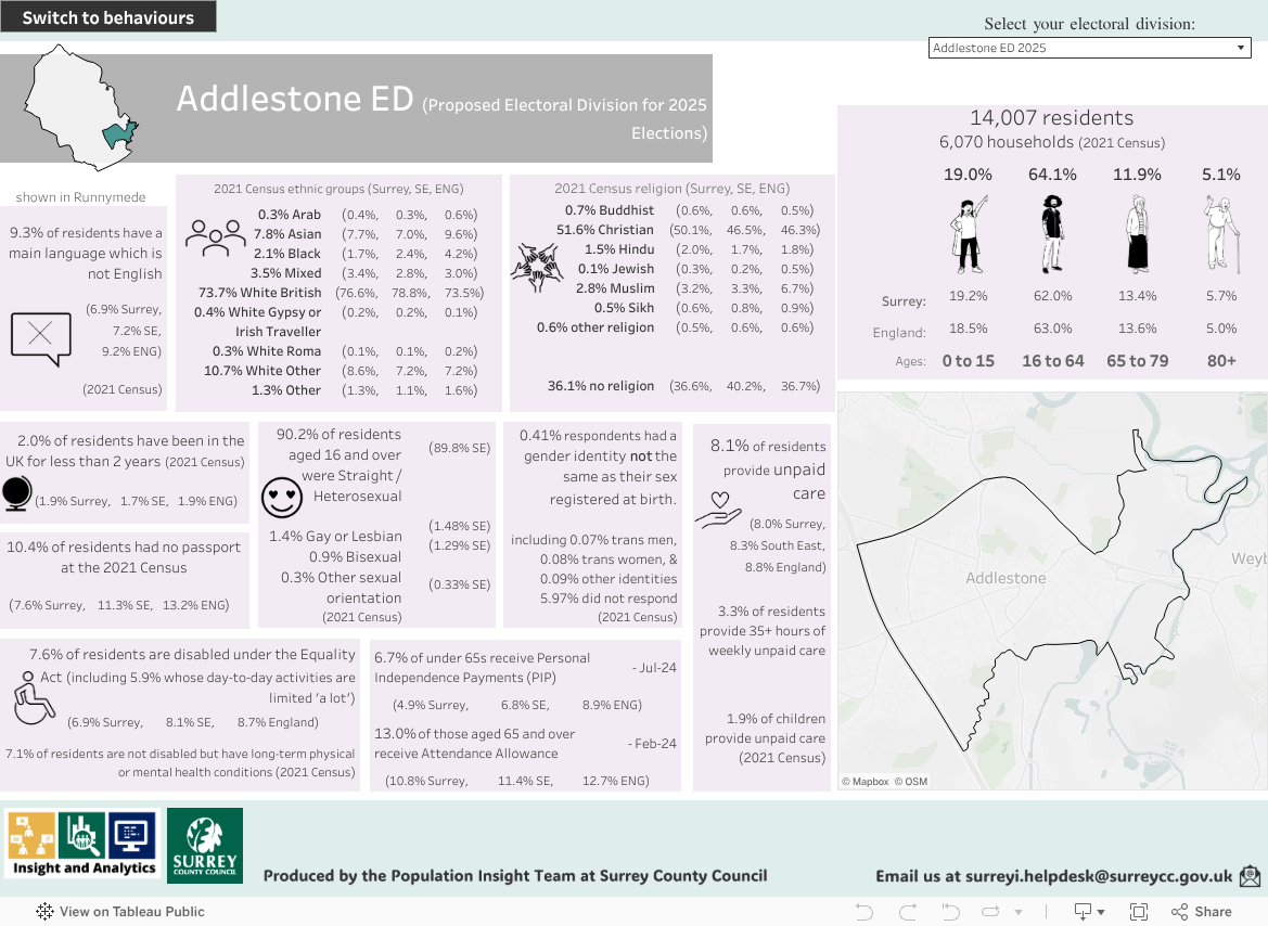
Clicking on the ‘Share’ button at the bottom right of the dashboard gives the option to download the pages as PDFs or other formats.
The current electoral boundaries before May 2025

Clicking on the ‘Share’ button at the bottom right of the dashboard gives the option to download the pages as PDFs or other formats.